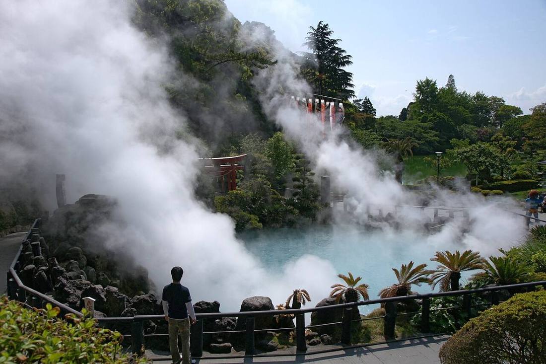
Photo: 663highland / CC BY 2.5 · Wikimedia Commons
Oita Prefecture
Kyushu & Okinawa region · Prefecture
Official website
Oita Prefecture is the "Onsen Prefecture," with many hot spring sources and a large volume of hot water. The Beppu Hatto (eight hot spring areas of Beppu) and Yufuin attract visitors from Japan and abroad. The prefecture also produces dried shiitake mushrooms and kabosu citrus, and toriten (chicken tempura), Seki-aji (horse mackerel) and Seki-saba (mackerel) are local specialties.
- Onsen Prefecture
- Beppu Hells tour (Jigoku Meguri)
- Kabosu
- Seki-aji and Seki-saba
Key facts
- Municipalities
- 18 (14 cities, 3 towns, 1 village)
Source: Statistics Bureau of Japan, 2025 Population Census (population, area and density); area from the Geospatial Information Authority of Japan (GSI), Area Statistics of Prefectures and Municipalities (2025). National ranks are among the 47 prefectures, ordered by this site from these values.
Places to know
- Beppu City A hot spring city where clouds of steam rise.
- Yufu City Yufuin, a hot spring area with views of Mt. Yufu.
- Usa City Usa Jingu, the head shrine of all Hachiman shrines in Japan.
Current warnings, advisories and earthquakes
Places to visit in Oita Prefecture
Browse by category
Shrines, temples, castles and historic sites
Chosen automatically, most popular first, from landmarks and cultural properties registered in Wikidata (we have not checked whether each is open). Names and descriptions: Wikidata (CC0); photos: Wikimedia Commons (photographer and license under each photo).
National parks in Oita Prefecture
Chosen by overlaying the park boundaries (Ministry of the Environment, Biodiversity Center of Japan, "National Park Areas" GIS data, updated April 28, 2025, combined and simplified by NIPPON ATLAS) with municipal boundaries (National Land Numerical Information, January 2021), keeping overlaps of about 0.5 km² or more (approximate). Areas are the land areas from the Ministry of the Environment, "Overview of National Parks" (April 10, 2026). All national parks
Municipalities in Oita Prefecture (18)
| Municipality | Population | 5-year change | Area | Temperature nownearest AMeDAS |
|---|
| Oita City | 470,076 | −1.2% | 502 km² | |
| Beppu City | 112,309 | −2.6% | 125 km² | |
| Nakatsu City | 80,096 | −3.3% | 491 km² | |
| Hita City | 57,874 | −7.6% | 666 km² | |
| Saiki City | 60,646 | −9.3% | 903 km² | |
| Usuki City | 32,685 | −9.6% | 291 km² | |
| Tsukumi City | 14,047 | −12.8% | 79.48 km² | |
| Taketa City | 17,657 | −13.2% | 478 km² | |
| Bungotakada City | 21,229 | −4.0% | 206 km² | |
| Kitsuki City | 25,219 | −9.9% | 280 km² | |
| Usa City | 49,210 | −6.7% | 439 km² | |
| Bungo-ono City | 30,212 | −10.3% | 603 km² | |
| Yufu City | 32,586 | −0.6% | 319 km² | |
| Kunisaki City | 23,658 | −9.8% | 318 km² | |
| Himeshima Village | 1,503 | −12.9% | 6.99 km² | |
| Hiji Town | 26,936 | −2.8% | 73.26 km² | |
| Kokonoe Town | 7,501 | −12.2% | 271 km² | |
| Kusu Town | 12,909 | −10.3% | 287 km² | |
Source: Statistics Bureau of Japan, 2025 Population Census (population in 2025; change compared with 2020). Area: GSI (2025). Designated cities are shown as one city (wards combined). "Temperature now" is the latest JMA AMeDAS observation (preliminary) at the nearest station in the same prefecture, loaded and shown unchanged when you open the page.