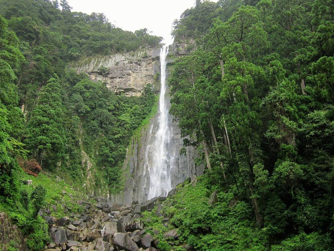
Photo: Suikotei / CC BY-SA 4.0 · Wikimedia Commons
Wakayama Prefecture
Kansai (Kinki) region · Prefecture
Official website
The "Land of Trees," occupying the southwest of the Kii Peninsula. It ranks 1st in Japan for production of mandarins, plums and persimmons. It has two great sacred sites, Mt. Koya and the Kumano Sanzan, and the Nanki hot springs such as Shirahama and Katsuura are also popular.
- Mandarins and Nanko plums
- Mt. Koya and Kumano Kodo (World Cultural Heritage)
- Shirahama
- Yuasa, birthplace of soy sauce
Key facts
- Municipalities
- 30 (9 cities, 20 towns, 1 village)
Source: Statistics Bureau of Japan, 2025 Population Census (population, area and density); area from the Geospatial Information Authority of Japan (GSI), Area Statistics of Prefectures and Municipalities (2025). National ranks are among the 47 prefectures, ordered by this site from these values.
Places to know
- Koya Town Mt. Koya, the sacred site of Shingon esoteric Buddhism founded by Kobo Daishi.
- Shirahama Town Shirarahama Beach of white sand and Shirahama Onsen, one of Japan's three oldest hot springs.
- Kitayama Village Japan's only exclave village. Raft rides and jabara citrus.
Current warnings, advisories and earthquakes
Places to visit in Wakayama Prefecture
 World Heritage Site · Koya TownMt. KoyaBuddhist temple complex and settlement in Wakayama Prefecture, Japan
 Buddhist temple · Koya TownKongobu-ji TempleBuddhist temple in Wakayama Prefecture, Japan
 Waterfall · Nachikatsuura TownNachi Fallswaterfall in Wakayama Prefecture, Japan
 Shinto shrine · Tanabe CityKumano Hongu TaishaShinto shrine in Wakayama Prefecture, Japan
 Shinto shrine · Shingu City, WakayamaKumano Hayatama TaishaShinto shrine in Wakayama Prefecture, Japan
 Buddhist temple · Nachikatsuura TownSeiganto-ji TempleBuddhist temple in Wakayama Prefecture, Japan
 Castle · Wakayama CityWakayama Castlefortification
 Shinto shrine · Nachikatsuura TownKumano Nachi TaishaShinto shrine in Nachikatsuura, Wakayama Prefecture, Japan
 Shinto shrine · Katsuragi Town, WakayamaNiutsuhime ShrineShinto shrine in Katsuragi, Ito district, Wakayama prefecture, Japan
 Buddhist temple · Nachikatsuura TownFudarakusan-ji TempleBuddhist temple in Wakayama Prefecture, Japan
Browse by category
Shrines, temples, castles and historic sites
Chosen automatically, most popular first, from landmarks and cultural properties registered in Wikidata (we have not checked whether each is open). Names and descriptions: Wikidata (CC0); photos: Wikimedia Commons (photographer and license under each photo).
National parks in Wakayama Prefecture
Chosen by overlaying the park boundaries (Ministry of the Environment, Biodiversity Center of Japan, "National Park Areas" GIS data, updated April 28, 2025, combined and simplified by NIPPON ATLAS) with municipal boundaries (National Land Numerical Information, January 2021), keeping overlaps of about 0.5 km² or more (approximate). Areas are the land areas from the Ministry of the Environment, "Overview of National Parks" (April 10, 2026). All national parks
Municipalities in Wakayama Prefecture (30)
| Municipality | Population | 5-year change | Area | Temperature nownearest AMeDAS |
|---|
| Wakayama City | 341,716 | −4.2% | 209 km² | |
| Kainan City | 43,853 | −9.3% | 101 km² | |
| Hashimoto City | 56,762 | −6.7% | 131 km² | |
| Arida City | 23,024 | −13.2% | 36.83 km² | |
| Gobo City | 20,986 | −10.6% | 43.91 km² | |
| Tanabe City | 64,288 | −8.0% | 1,027 km² | |
| Shingu City | 24,331 | −10.5% | 255 km² | |
| Kinokawa City | 55,789 | −5.1% | 228 km² | |
| Iwade City | 53,582 | −0.7% | 38.51 km² | |
| Kimino Town | 7,229 | −12.4% | 128 km² | |
| Katsuragi Town | 14,558 | −8.8% | 152 km² | |
| Kudoyama Town | 3,442 | −10.7% | 44.15 km² | |
| Koya Town | 2,589 | −12.8% | 137 km² | |
| Yuasa Town | 10,022 | −9.9% | 20.80 km² | |
| Hirogawa Town | 6,094 | −10.1% | 65.35 km² | |
| Aridagawa Town | 23,789 | −5.8% | 352 km² | |
| Mihama Town | 6,050 | −11.9% | 12.77 km² | |
| Hidaka Town | 7,667 | −0.1% | 46.21 km² | |
| Yura Town | 4,627 | −13.7% | 30.93 km² | |
| Inami Town | 6,926 | −10.3% | 114 km² | |
| Minabe Town | 10,696 | −9.5% | 120 km² | |
| Hidakagawa Town | 8,352 | −9.4% | 332 km² | |
| Shirahama Town | 18,423 | −9.1% | 201 km² | |
| Kamitonda Town | 15,081 | −1.0% | 57.37 km² | |
| Susami Town | 3,204 | −13.1% | 174 km² | |
| Nachikatsuura Town | 12,725 | −10.0% | 183 km² | |
| Taiji Town | 2,678 | −4.0% | 5.81 km² | |
| Kozagawa Town | 2,164 | −12.7% | 294 km² | |
| Kitayama Village | 356 | −11.9% | 48.20 km² | |
| Kushimoto Town | 12,754 | −14.7% | 136 km² | |
Source: Statistics Bureau of Japan, 2025 Population Census (population in 2025; change compared with 2020). Area: GSI (2025). Designated cities are shown as one city (wards combined). "Temperature now" is the latest JMA AMeDAS observation (preliminary) at the nearest station in the same prefecture, loaded and shown unchanged when you open the page.