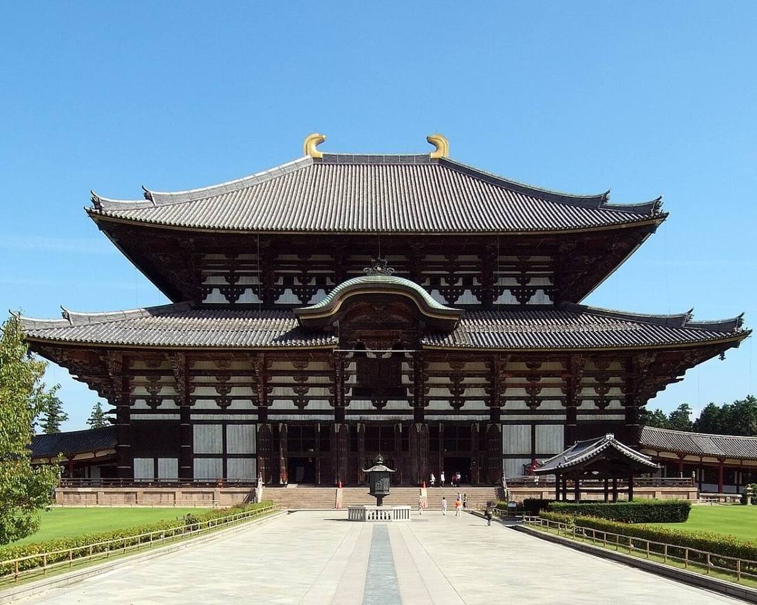
Photo: Wiiii / CC BY-SA 3.0 · Wikimedia Commons
Nara Prefecture
Kansai (Kinki) region · Prefecture
Official website
The place where Japan as a nation began, home to ancient capitals such as Asuka, Fujiwara-kyo and Heijo-kyo. Horyu-ji is known as the oldest wooden building in the world, and with the Great Buddha of Todai-ji, the deer of Nara Park and the cherry blossoms of Yoshino, 1,300 years of history are part of daily life. The south is the deep Kii Mountains.
- Horyu-ji Temple (World Cultural Heritage)
- Historic Monuments of Ancient Nara
- Cherry blossoms of Yoshino
- Kakinoha-zushi (persimmon-leaf sushi)
Key facts
- Municipalities
- 39 (12 cities, 15 towns, 12 villages)
Source: Statistics Bureau of Japan, 2025 Population Census (population, area and density); area from the Geospatial Information Authority of Japan (GSI), Area Statistics of Prefectures and Municipalities (2025). National ranks are among the 47 prefectures, ordered by this site from these values.
Places to know
- Nara City Todai-ji, Kasuga-taisha and the deer of Nara Park.
- Ikaruga Town A town connected with Prince Shotoku, home of Horyu-ji.
- Totsukawa Village The largest village in Japan, excluding the Northern Territories. The Kumano Kodo and hot springs.
Current warnings, advisories and earthquakes
Places to visit in Nara Prefecture
Browse by category
Shrines, temples, castles and historic sites
Chosen automatically, most popular first, from landmarks and cultural properties registered in Wikidata (we have not checked whether each is open). Names and descriptions: Wikidata (CC0); photos: Wikimedia Commons (photographer and license under each photo).
National parks in Nara Prefecture
Chosen by overlaying the park boundaries (Ministry of the Environment, Biodiversity Center of Japan, "National Park Areas" GIS data, updated April 28, 2025, combined and simplified by NIPPON ATLAS) with municipal boundaries (National Land Numerical Information, January 2021), keeping overlaps of about 0.5 km² or more (approximate). Areas are the land areas from the Ministry of the Environment, "Overview of National Parks" (April 10, 2026). All national parks
Municipalities in Nara Prefecture (39)
| Municipality | Population | 5-year change | Area | Temperature nownearest AMeDAS |
|---|
| Nara City | 338,251 | −4.6% | 277 km² | |
| Yamatotakada City | 59,489 | −3.7% | 16.48 km² | |
| Yamatokoriyama City | 80,943 | −2.8% | 42.69 km² | |
| Tenri City | 59,554 | −6.8% | 86.42 km² | |
| Kashihara City | 117,603 | −2.7% | 39.56 km² | |
| Sakurai City | 52,395 | −4.5% | 98.91 km² | |
| Gojo City | 25,253 | −9.6% | 292 km² | |
| Gose City | 21,505 | −10.8% | 60.58 km² | |
| Ikoma City | 114,651 | −1.7% | 53.15 km² | |
| Kashiba City | 77,374 | −0.9% | 24.26 km² | |
| Katsuragi City | 36,748 | −0.2% | 33.72 km² | |
| Uda City | 25,212 | −10.3% | 248 km² | |
| Yamazoe Village | 2,821 | −12.6% | 66.52 km² | |
| Heguri Town | 17,339 | −3.7% | 23.90 km² | |
| Sango Town | 22,314 | −3.9% | 8.79 km² | |
| Ikaruga Town | 26,990 | −2.2% | 14.27 km² | |
| Ando Town | 6,765 | −6.4% | 4.31 km² | |
| Kawanishi Town | 7,605 | −6.9% | 5.93 km² | |
| Miyake Town | 6,045 | −6.1% | 4.06 km² | |
| Tawaramoto Town | 30,546 | −2.0% | 21.09 km² | |
| Soni Village | 1,142 | −11.8% | 47.76 km² | |
| Mitsue Village | 1,225 | −17.2% | 79.58 km² | |
| Takatori Town | 6,039 | −10.3% | 25.79 km² | |
| Asuka Village | 4,791 | −7.5% | 24.10 km² | |
| Kanmaki Town | 20,889 | −3.8% | 6.14 km² | |
| Oji Town | 23,396 | −2.7% | 7.01 km² | |
| Koryo Town | 33,473 | −1.0% | 16.30 km² | |
| Kawai Town | 15,691 | −7.8% | 8.23 km² | |
| Yoshino Town | 5,221 | −16.2% | 95.65 km² | |
| Oyodo Town | 15,051 | −10.0% | 38.10 km² | |
| Shimoichi Town | 4,110 | −18.4% | 61.99 km² | |
| Kurotaki Village | 515 | −17.3% | 47.70 km² | |
| Tenkawa Village | 1,026 | −12.8% | 176 km² | |
| Nosegawa Village | 289 | −19.0% | 155 km² | |
| Totsukawa Village | 2,594 | −15.3% | 672 km² | |
| Shimokitayama Village | 701 | −6.9% | 133 km² | |
| Kamikitayama Village | 375 | −15.5% | 274 km² | |
| Kawakami Village | 969 | −16.2% | 269 km² | |
| Higashiyoshino Village | 1,281 | −14.7% | 132 km² | |
Source: Statistics Bureau of Japan, 2025 Population Census (population in 2025; change compared with 2020). Area: GSI (2025). Designated cities are shown as one city (wards combined). "Temperature now" is the latest JMA AMeDAS observation (preliminary) at the nearest station in the same prefecture, loaded and shown unchanged when you open the page.