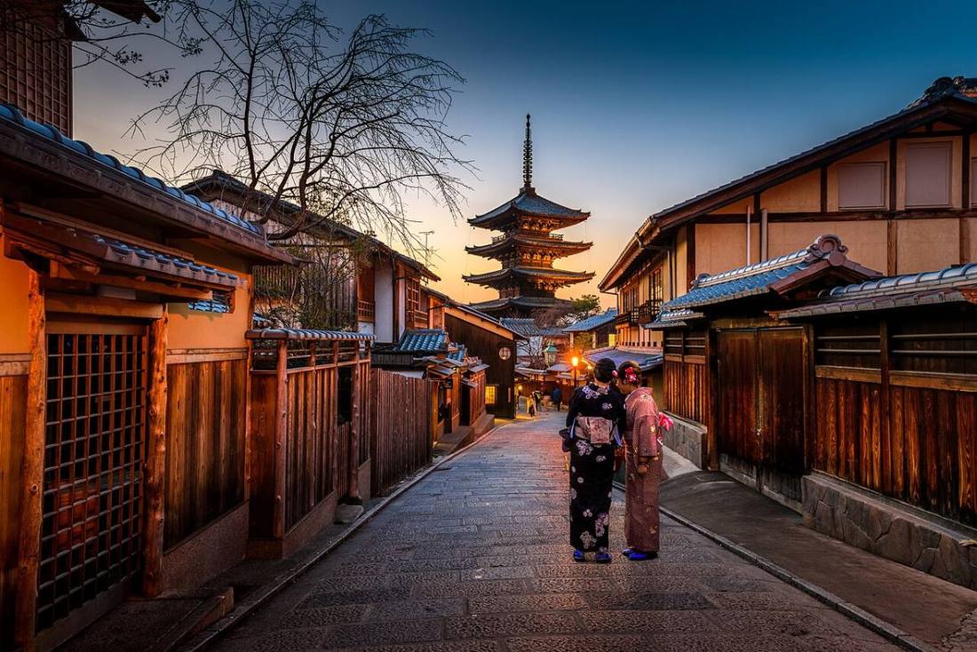
Photo: Sorasak boontohhgraphy / CC0 · Wikimedia Commons
Kyoto Prefecture
Kansai (Kinki) region · Prefecture
Official website
The ancient capital that was Japan's capital for more than 1,000 years after the move to Heian-kyo in 794. Many temples and shrines and Nijo Castle are World Heritage Sites, and refined culture such as Nishijin textiles, Kiyomizu ware and Kyoto cuisine lives on. The north, facing the Sea of Japan, is "Kyoto by the Sea."
- Historic Monuments of Ancient Kyoto (World Cultural Heritage)
- Uji tea
- Amanohashidate
- Gion Festival
Key facts
- Municipalities
- 26 (15 cities, 10 towns, 1 village)
Source: Statistics Bureau of Japan, 2025 Population Census (population, area and density); area from the Geospatial Information Authority of Japan (GSI), Area Statistics of Prefectures and Municipalities (2025). National ranks are among the 47 prefectures, ordered by this site from these values.
Places to know
- Kyoto City Kiyomizu-dera, Kinkaku-ji and Fushimi Inari. Visitors come all year round.
- Uji City Byodo-in's Phoenix Hall and Uji tea.
- Ine Town A fishing village with funaya boathouses lined up facing the sea.
Current warnings, advisories and earthquakes
Places to visit in Kyoto Prefecture
 Buddhist temple · Kyoto CityKiyomizu-deraBuddhist temple in Higashiyama-ku, Kyoto
 Buddhist temple · Kyoto CityKinkaku-ji TempleZen Buddhist temple in Kyoto, Japan
 Buddhist temple · Uji CityByodo-in TempleBuddhist temple in Kyoto Prefecture, Japan
 Castle · Kyoto CityNijo Castlecastle in Kyoto, Japan
 Buddhist temple · Kyoto CityGinkaku-ji Templetemple in Sakyo ward of Kyoto, Japan
 Shinto shrine · Kyoto CityFushimi Inari-taishaShinto shrines in Kyoto, Japan
 Shinto shrine · Kyoto CityKamigamo ShrineShinto shrine in Kita-ku, Kyōto, Japan
 Landmark · Miyazu CityAmanohashidateone of Japan's three scenic views
 Shinto shrine · Kyoto CityShimogamo ShrineShinto shrine in Sakyō-ku, Kyōto, Japan
 Place of scenic beauty · Kyoto CityArashiyamahuman settlement in Japan
Browse by category
Shrines, temples, castles and historic sites
Chosen automatically, most popular first, from landmarks and cultural properties registered in Wikidata (we have not checked whether each is open). Names and descriptions: Wikidata (CC0); photos: Wikimedia Commons (photographer and license under each photo).
National parks in Kyoto Prefecture
Chosen by overlaying the park boundaries (Ministry of the Environment, Biodiversity Center of Japan, "National Park Areas" GIS data, updated April 28, 2025, combined and simplified by NIPPON ATLAS) with municipal boundaries (National Land Numerical Information, January 2021), keeping overlaps of about 0.5 km² or more (approximate). Areas are the land areas from the Ministry of the Environment, "Overview of National Parks" (April 10, 2026). All national parks
Municipalities in Kyoto Prefecture (26)
| Municipality | Population | 5-year change | Area | Temperature nownearest AMeDAS |
|---|
| Kyoto City | 1,430,062 | −2.3% | 828 km² | |
| Fukuchiyama City | 73,490 | −4.9% | 553 km² | |
| Maizuru City | 73,046 | −9.1% | 342 km² | |
| Ayabe City | 29,829 | −6.3% | 347 km² | |
| Uji City | 172,873 | −3.8% | 67.54 km² | |
| Miyazu City | 15,056 | −10.2% | 173 km² | |
| Kameoka City | 83,181 | −3.5% | 225 km² | |
| Joyo City | 71,707 | −3.9% | 32.71 km² | |
| Muko City | 55,209 | −2.9% | 7.72 km² | |
| Nagaokakyo City | 81,528 | +1.1% | 19.17 km² | |
| Yawata City | 67,606 | −4.0% | 24.35 km² | |
| Kyotanabe City | 74,315 | +0.8% | 42.92 km² | |
| Kyotango City | 46,676 | −8.2% | 501 km² | |
| Nantan City | 30,011 | −5.1% | 616 km² | |
| Kizugawa City | 77,893 | −0.0% | 85.13 km² | |
| Oyamazaki Town | 15,967 | +0.1% | 5.97 km² | |
| Kumiyama Town | 14,669 | −3.8% | 13.86 km² | |
| Ide Town | 7,010 | −5.3% | 18.04 km² | |
| Ujitawara Town | 8,404 | −5.7% | 58.16 km² | |
| Kasagi Town | 953 | −16.7% | 23.52 km² | |
| Wazuka Town | 2,968 | −14.7% | 64.93 km² | |
| Seika Town | 34,515 | −4.6% | 25.68 km² | |
| Minamiyamashiro Village | 2,136 | −10.7% | 64.11 km² | |
| Kyotanba Town | 11,341 | −12.1% | 303 km² | |
| Ine Town | 1,692 | −12.2% | 61.95 km² | |
| Yosano Town | 18,036 | −10.2% | 108 km² | |
Source: Statistics Bureau of Japan, 2025 Population Census (population in 2025; change compared with 2020). Area: GSI (2025). Designated cities are shown as one city (wards combined). "Temperature now" is the latest JMA AMeDAS observation (preliminary) at the nearest station in the same prefecture, loaded and shown unchanged when you open the page.