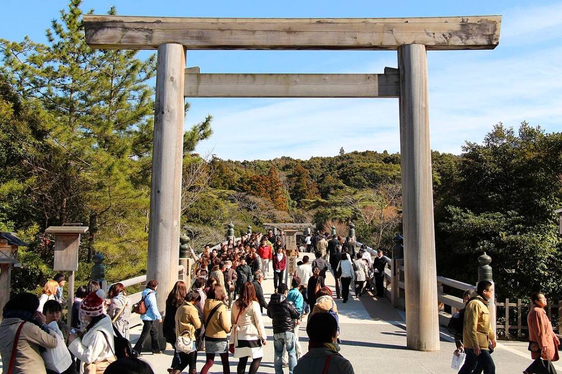
Photo: Kanchi1979 / CC BY-SA 4.0 · Wikimedia Commons
Mie Prefecture
Kansai (Kinki) region · Prefecture
Official website
Home of Ise Jingu, it is called "the spiritual home of the Japanese people." Besides its rich food, such as spiny lobster, pearls and Matsusaka beef, it also has an industrial side, with the Yokkaichi petrochemical complex and Suzuka Circuit.
- Ise Jingu
- Matsusaka beef
- Kumano Kodo (World Cultural Heritage)
- Pearls
Key facts
- Municipalities
- 29 (14 cities, 15 towns)
Source: Statistics Bureau of Japan, 2025 Population Census (population, area and density); area from the Geospatial Information Authority of Japan (GSI), Area Statistics of Prefectures and Municipalities (2025). National ranks are among the 47 prefectures, ordered by this site from these values.
Places to know
- Ise City Ise Jingu and Okage Yokocho.
- Toba City Mikimoto Pearl Island and the culture of ama (women divers).
- Suzuka City Suzuka Circuit, home of the F1 Japanese Grand Prix.
Current warnings, advisories and earthquakes
Places to visit in Mie Prefecture
Browse by category
Shrines, temples, castles and historic sites
Chosen automatically, most popular first, from landmarks and cultural properties registered in Wikidata (we have not checked whether each is open). Names and descriptions: Wikidata (CC0); photos: Wikimedia Commons (photographer and license under each photo).
National parks in Mie Prefecture
Chosen by overlaying the park boundaries (Ministry of the Environment, Biodiversity Center of Japan, "National Park Areas" GIS data, updated April 28, 2025, combined and simplified by NIPPON ATLAS) with municipal boundaries (National Land Numerical Information, January 2021), keeping overlaps of about 0.5 km² or more (approximate). Areas are the land areas from the Ministry of the Environment, "Overview of National Parks" (April 10, 2026). All national parks
Municipalities in Mie Prefecture (29)
| Municipality | Population | 5-year change | Area | Temperature nownearest AMeDAS |
|---|
| Tsu City | 263,544 | −4.0% | 711 km² | |
| Yokkaichi City | 303,531 | −0.6% | 207 km² | |
| Ise City | 115,379 | −6.0% | 208 km² | |
| Matsusaka City | 150,653 | −5.3% | 624 km² | |
| Kuwana City | 133,809 | −3.5% | 137 km² | |
| Suzuka City | 189,731 | −3.0% | 194 km² | |
| Nabari City | 71,953 | −5.8% | 130 km² | |
| Owase City | 14,090 | −13.3% | 193 km² | |
| Kameyama City | 49,105 | −1.5% | 191 km² | |
| Toba City | 15,124 | −13.7% | 107 km² | |
| Kumano City | 13,976 | −12.5% | 373 km² | |
| Inabe City | 44,047 | −2.1% | 220 km² | |
| Shima City | 40,487 | −12.1% | 179 km² | |
| Iga City | 81,770 | −7.9% | 558 km² | |
| Kisosaki Town | 5,720 | −5.0% | 15.74 km² | |
| Toin Town | 25,333 | −1.7% | 22.68 km² | |
| Komono Town | 39,257 | −3.2% | 107 km² | |
| Asahi Town | 11,061 | +0.4% | 5.99 km² | |
| Kawagoe Town | 15,786 | +4.4% | 8.72 km² | |
| Taki Town | 12,898 | −8.0% | 103 km² | |
| Meiwa Town | 21,449 | −4.4% | 41.06 km² | |
| Odai Town | 7,777 | −10.3% | 363 km² | |
| Tamaki Town | 14,374 | −4.4% | 40.91 km² | |
| Watarai Town | 7,215 | −8.1% | 135 km² | |
| Taiki Town | 6,553 | −16.1% | 233 km² | |
| Minamiise Town | 9,206 | −16.2% | 242 km² | |
| Kihoku Town | 12,460 | −14.7% | 257 km² | |
| Mihama Town | 7,297 | −9.7% | 88.13 km² | |
| Kiho Town | 9,640 | −6.6% | 79.62 km² | |
Source: Statistics Bureau of Japan, 2025 Population Census (population in 2025; change compared with 2020). Area: GSI (2025). Designated cities are shown as one city (wards combined). "Temperature now" is the latest JMA AMeDAS observation (preliminary) at the nearest station in the same prefecture, loaded and shown unchanged when you open the page.