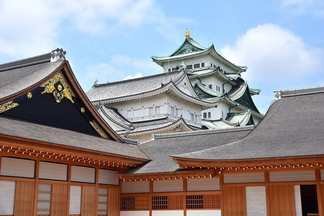
Photo: Bariston / CC BY-SA 4.0 · Wikimedia Commons
Aichi Prefecture
Chubu region · Prefecture
Official website
It ranks 1st in Japan in the value of manufactured goods shipments and is a center of the car industry, led by Toyota. It is also known for Nagoya-meshi (Nagoya food), Nagoya Castle and its ties to the three great unifiers of the Warring States period (Nobunaga, Hideyoshi and Ieyasu).
- Car industry
- Nagoya-meshi (local food)
- Three great unifiers
- Seto ware and Tokoname ware
Key facts
- Municipalities
- 54 (38 cities, 14 towns, 2 villages)
Source: Statistics Bureau of Japan, 2025 Population Census (population, area and density); area from the Geospatial Information Authority of Japan (GSI), Area Statistics of Prefectures and Municipalities (2025). National ranks are among the 47 prefectures, ordered by this site from these values.
Places to know
- Nagoya City The center of the Chukyo area, with a population of about 2.35 million. The golden shachihoko (castle roof ornaments).
- Toyota City A company town with the head office of Toyota Motor.
- Inuyama City Inuyama Castle, a National Treasure, and Museum Meiji-mura.
Current warnings, advisories and earthquakes
Places to visit in Aichi Prefecture
Browse by category
Shrines, temples, castles and historic sites
Chosen automatically, most popular first, from landmarks and cultural properties registered in Wikidata (we have not checked whether each is open). Names and descriptions: Wikidata (CC0); photos: Wikimedia Commons (photographer and license under each photo).
Municipalities in Aichi Prefecture (54)
| Municipality | Population | 5-year change | Area | Temperature nownearest AMeDAS |
|---|
| Nagoya City | 2,345,186 | +0.6% | 326 km² | |
| Toyohashi City | 359,759 | −3.3% | 262 km² | |
| Okazaki City | 377,631 | −1.8% | 387 km² | |
| Ichinomiya City | 368,788 | −3.0% | 114 km² | |
| Seto City | 123,379 | −3.5% | 111 km² | |
| Handa City | 113,466 | −3.7% | 47.42 km² | |
| Kasugai City | 302,914 | −1.9% | 92.78 km² | |
| Toyokawa City | 182,448 | −1.2% | 161 km² | |
| Tsushima City | 57,768 | −5.2% | 25.09 km² | |
| Hekinan City | 71,215 | −1.7% | 36.68 km² | |
| Kariya City | 152,650 | −0.8% | 50.39 km² | |
| Toyota City | 412,507 | −2.3% | 918 km² | |
| Anjo City | 186,251 | −0.9% | 86.05 km² | |
| Nishio City | 166,055 | −1.8% | 161 km² | |
| Gamagori City | 74,921 | −5.8% | 56.96 km² | |
| Inuyama City | 69,953 | −4.3% | 74.90 km² | |
| Tokoname City | 57,815 | −1.5% | 55.90 km² | |
| Konan City | 94,138 | −4.2% | 30.20 km² | |
| Komaki City | 144,828 | −2.7% | 62.81 km² | |
| Inazawa City | 129,992 | −3.5% | 79.35 km² | |
| Shinshiro City | 40,662 | −8.3% | 499 km² | |
| Tokai City | 112,433 | −1.2% | 43.42 km² | |
| Obu City | 92,418 | −0.8% | 33.67 km² | |
| Chita City | 82,051 | −2.7% | 45.90 km² | |
| Chiryu City | 72,548 | +0.5% | 16.31 km² | |
| Owariasahi City | 82,440 | −0.8% | 21.03 km² | |
| Takahama City | 48,079 | +4.3% | 13.11 km² | |
| Iwakura City | 47,393 | −1.2% | 10.47 km² | |
| Toyoake City | 68,344 | −1.4% | 23.22 km² | |
| Nisshin City | 94,724 | +3.5% | 34.91 km² | |
| Tahara City | 56,473 | −4.9% | 191 km² | |
| Aisai City | 57,755 | −5.1% | 66.68 km² | |
| Kiyosu City | 68,165 | +1.2% | 17.35 km² | |
| Kitanagoya City | 85,678 | −0.8% | 18.37 km² | |
| Yatomi City | 42,206 | −1.9% | 49.26 km² | |
| Miyoshi City | 61,458 | −0.8% | 32.19 km² | |
| Ama City | 86,502 | +0.4% | 27.49 km² | |
| Nagakute City | 63,461 | +5.5% | 21.55 km² | |
| Togo Town | 43,879 | −0.1% | 18.03 km² | |
| Toyoyama Town | 15,784 | +1.1% | 6.18 km² | |
| Oguchi Town | 23,524 | −3.2% | 13.61 km² | |
| Fuso Town | 34,132 | −0.0% | 11.19 km² | |
| Oharu Town | 32,408 | +0.0% | 6.59 km² | |
| Kanie Town | 36,439 | −2.4% | 11.09 km² | |
| Tobishima Village | 4,386 | −4.1% | 22.43 km² | |
| Agui Town | 27,473 | −3.2% | 23.80 km² | |
| Higashiura Town | 48,924 | −1.4% | 31.14 km² | |
| Minamichita Town | 14,434 | −13.1% | 38.23 km² | |
| Mihama Town | 20,497 | −8.9% | 46.20 km² | |
| Taketoyo Town | 42,924 | −1.4% | 26.37 km² | |
| Kota Town | 41,546 | −2.1% | 56.72 km² | |
| Shitara Town | 3,927 | −11.5% | 274 km² | |
| Toei Town | 2,477 | −15.8% | 123 km² | |
| Toyone Village | 835 | −17.9% | 156 km² | |
Source: Statistics Bureau of Japan, 2025 Population Census (population in 2025; change compared with 2020). Area: GSI (2025). Designated cities are shown as one city (wards combined). "Temperature now" is the latest JMA AMeDAS observation (preliminary) at the nearest station in the same prefecture, loaded and shown unchanged when you open the page.