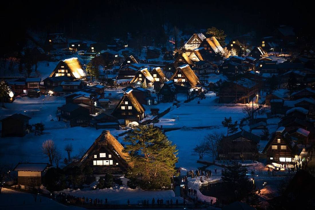
Photo: Jordy Meow / CC BY-SA 3.0 · Wikimedia Commons
Gifu Prefecture
Chubu region · Prefecture
Official website
Close to the center of Japan's population, it calls itself "the middle of Japan." It is divided into mountainous Hida and the plains of Mino, and traditional industries such as Seki cutlery, Mino ware and Mino washi paper are still alive. Cormorant fishing on the Nagara River has a history of 1,300 years.
- Shirakawa-go (World Cultural Heritage)
- Hida Takayama
- Seki cutlery
- Nagara River cormorant fishing
Key facts
- Municipalities
- 42 (21 cities, 19 towns, 2 villages)
Source: Statistics Bureau of Japan, 2025 Population Census (population, area and density); area from the Geospatial Information Authority of Japan (GSI), Area Statistics of Prefectures and Municipalities (2025). National ranks are among the 47 prefectures, ordered by this site from these values.
Places to know
- Takayama City Old streets and the Takayama Festival. The largest area of any municipality in Japan.
- Shirakawa Village Shirakawa-go, a village of gassho-style houses.
- Sekigahara Town The battlefield of the decisive battle for control of Japan.
Current warnings, advisories and earthquakes
Places to visit in Gifu Prefecture
Browse by category
Shrines, temples, castles and historic sites
Chosen automatically, most popular first, from landmarks and cultural properties registered in Wikidata (we have not checked whether each is open). Names and descriptions: Wikidata (CC0); photos: Wikimedia Commons (photographer and license under each photo).
National parks in Gifu Prefecture
Chosen by overlaying the park boundaries (Ministry of the Environment, Biodiversity Center of Japan, "National Park Areas" GIS data, updated April 28, 2025, combined and simplified by NIPPON ATLAS) with municipal boundaries (National Land Numerical Information, January 2021), keeping overlaps of about 0.5 km² or more (approximate). Areas are the land areas from the Ministry of the Environment, "Overview of National Parks" (April 10, 2026). All national parks
Municipalities in Gifu Prefecture (42)
| Municipality | Population | 5-year change | Area | Temperature nownearest AMeDAS |
|---|
| Gifu City | 388,454 | −3.5% | 204 km² | |
| Ogaki City | 154,351 | −2.5% | 207 km² | |
| Takayama City | 79,301 | −6.1% | 2,178 km² | |
| Tajimi City | 101,453 | −4.9% | 91.25 km² | |
| Seki City | 80,797 | −5.3% | 472 km² | |
| Nakatsugawa City | 70,962 | −7.3% | 676 km² | |
| Mino City | 17,570 | −8.7% | 117 km² | |
| Mizunami City | 35,017 | −5.7% | 175 km² | |
| Hashima City | 64,401 | −1.9% | 53.66 km² | |
| Ena City | 43,791 | −8.3% | 504 km² | |
| Minokamo City | 56,815 | +0.2% | 74.81 km² | |
| Toki City | 51,010 | −7.8% | 116 km² | |
| Kakamigahara City | 141,136 | −2.3% | 87.81 km² | |
| Kani City | 97,153 | −2.8% | 87.57 km² | |
| Yamagata City | 23,324 | −7.7% | 222 km² | |
| Mizuho City | 56,616 | +0.4% | 28.19 km² | |
| Hida City | 20,462 | −9.2% | 793 km² | |
| Motosu City | 31,856 | −3.3% | 375 km² | |
| Gujo City | 35,518 | −8.9% | 1,031 km² | |
| Gero City | 27,320 | −10.2% | 851 km² | |
| Kaizu City | 29,870 | −8.8% | 112 km² | |
| Ginan Town | 26,130 | +1.0% | 7.91 km² | |
| Kasamatsu Town | 21,793 | −1.9% | 10.30 km² | |
| Yoro Town | 24,356 | −9.4% | 72.29 km² | |
| Tarui Town | 24,911 | −5.6% | 57.09 km² | |
| Sekigahara Town | 5,772 | −12.7% | 49.28 km² | |
| Godo Town | 17,572 | −5.5% | 18.78 km² | |
| Wanouchi Town | 8,924 | −7.6% | 22.33 km² | |
| Anpachi Town | 13,881 | −3.3% | 18.16 km² | |
| Ibigawa Town | 17,277 | −11.5% | 803 km² | |
| Ono Town | 20,535 | −6.8% | 34.20 km² | |
| Ikeda Town | 21,539 | −7.8% | 38.80 km² | |
| Kitagata Town | 18,325 | +1.0% | 5.18 km² | |
| Sakahogi Town | 8,096 | +0.3% | 12.87 km² | |
| Tomika Town | 5,793 | +3.0% | 16.82 km² | |
| Kawabe Town | 9,223 | −6.5% | 41.16 km² | |
| Hichiso Town | 2,868 | −15.7% | 90.47 km² | |
| Yaotsu Town | 9,233 | −9.4% | 129 km² | |
| Shirakawa Town | 6,400 | −13.7% | 238 km² | |
| Higashishirakawa Village | 1,800 | −10.7% | 87.09 km² | |
| Mitake Town | 16,497 | −5.8% | 56.69 km² | |
| Shirakawa Village | 1,474 | −2.4% | 357 km² | |
Source: Statistics Bureau of Japan, 2025 Population Census (population in 2025; change compared with 2020). Area: GSI (2025). Designated cities are shown as one city (wards combined). "Temperature now" is the latest JMA AMeDAS observation (preliminary) at the nearest station in the same prefecture, loaded and shown unchanged when you open the page.