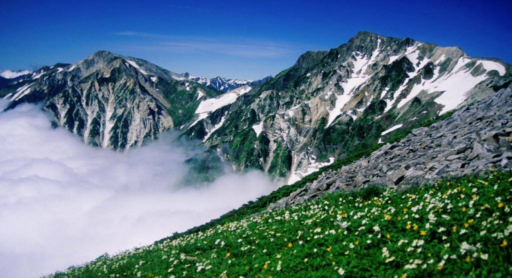
Photo: Alpsdake / CC0 · Wikimedia Commons
Nagano Prefecture
Chubu region · Prefecture
Official website
The "roof of Japan," home to the Northern, Central and Southern Alps. Its 35 villages are the most of any prefecture, and it borders 8 prefectures. It is also known for soba, lettuce, apples, miso and long life expectancy.
- Japan Alps
- Shinshu soba
- Zenko-ji Temple
- Skiing and hot springs
Key facts
- Municipalities
- 77 (19 cities, 23 towns, 35 villages)
Source: Statistics Bureau of Japan, 2025 Population Census (population, area and density); area from the Geospatial Information Authority of Japan (GSI), Area Statistics of Prefectures and Municipalities (2025). National ranks are among the 47 prefectures, ordered by this site from these values.
Places to know
- Nagano City The temple town of Zenko-ji. Host of the 1998 Winter Olympics.
- Matsumoto City Matsumoto Castle, a National Treasure, and the gateway to the Northern Alps.
- Karuizawa Town A summer resort since the Meiji era.
Current warnings, advisories and earthquakes
Places to visit in Nagano Prefecture
 Castle · Matsumoto CityMatsumoto Castlebuilding in Matsumoto, Nagano Prefecture, Japan
 Buddhist temple · Nagano CityZenko-ji TempleBuddhist temple in Nagano, Nagano Prefecture, Japan
 Valley · Matsumoto CityKamikochitourist attraction in Matsumoto, Nagano, Japan
 Lake · Okaya CityLake Suwalake in Nagano prefecture, Japan
 Shinto shrine · Shimosuwa TownSuwa taishaShinto shrine in Nagano Prefecture, Japan
 Castle · Ueda CityUeda Castlebuilding in Ueda, Nagano Prefecture, Japan
 Museum · Matsumoto CityFormer Kaichi SchoolMeiji-era pseudo-Western style school building in Matsumoto, Japan; first modern school building designated a National Treasure (2019)
 Shinto shrine · Shimosuwa TownOnbashirafestival held every six years in the Lake Suwa area of Nagano, Japan
 Castle · Komoro CityKomoro Castlefortification
 Old post town · Nagiso TownTsumago-jukutown in Japan
Browse by category
Shrines, temples, castles and historic sites
Chosen automatically, most popular first, from landmarks and cultural properties registered in Wikidata (we have not checked whether each is open). Names and descriptions: Wikidata (CC0); photos: Wikimedia Commons (photographer and license under each photo).
National parks in Nagano Prefecture
Chosen by overlaying the park boundaries (Ministry of the Environment, Biodiversity Center of Japan, "National Park Areas" GIS data, updated April 28, 2025, combined and simplified by NIPPON ATLAS) with municipal boundaries (National Land Numerical Information, January 2021), keeping overlaps of about 0.5 km² or more (approximate). Areas are the land areas from the Ministry of the Environment, "Overview of National Parks" (April 10, 2026). All national parks
Municipalities in Nagano Prefecture (77)
| Municipality | Population | 5-year change | Area | Temperature nownearest AMeDAS |
|---|
| Nagano City | 357,077 | −4.2% | 835 km² | |
| Matsumoto City | 232,241 | −3.7% | 978 km² | |
| Ueda City | 144,202 | −6.4% | 552 km² | |
| Okaya City | 44,482 | −6.9% | 85.10 km² | |
| Iida City | 90,765 | −7.5% | 659 km² | |
| Suwa City | 46,354 | −4.9% | 109 km² | |
| Suzaka City | 47,774 | −3.6% | 150 km² | |
| Komoro City | 40,185 | −2.0% | 98.55 km² | |
| Ina City | 63,508 | −4.0% | 668 km² | |
| Komagane City | 30,861 | −4.2% | 166 km² | |
| Nakano City | 40,223 | −5.0% | 112 km² | |
| Omachi City | 23,956 | −8.0% | 565 km² | |
| Iiyama City | 17,682 | −9.5% | 202 km² | |
| Chino City | 54,409 | −3.5% | 267 km² | |
| Shiojiri City | 65,442 | −2.7% | 290 km² | |
| Saku City | 97,017 | −1.2% | 424 km² | |
| Chikuma City | 57,103 | −3.0% | 120 km² | |
| Tomi City | 28,549 | −5.2% | 112 km² | |
| Azumino City | 91,794 | −2.6% | 332 km² | |
| Koumi Town | 4,048 | −7.0% | 114 km² | |
| Kawakami Village | 4,176 | −3.9% | 210 km² | |
| Minamimaki Village | 3,339 | +3.0% | 133 km² | |
| Minamiaiki Village | 866 | −10.0% | 66.05 km² | |
| Kitaaiki Village | 611 | −18.8% | 56.32 km² | |
| Sakuho Town | 9,570 | −6.3% | 188 km² | |
| Karuizawa Town | 18,483 | −3.7% | 156 km² | |
| Miyota Town | 16,546 | +6.4% | 58.79 km² | |
| Tateshina Town | 6,203 | −6.2% | 66.87 km² | |
| Aoki Village | 3,778 | −8.3% | 57.10 km² | |
| Nagawa Town | 5,148 | −8.1% | 184 km² | |
| Shimosuwa Town | 17,625 | −8.0% | 66.87 km² | |
| Fujimi Town | 13,366 | −5.1% | 145 km² | |
| Hara Village | 7,786 | +1.4% | 43.26 km² | |
| Tatsuno Town | 17,037 | −8.2% | 169 km² | |
| Minowa Town | 23,876 | −4.5% | 85.91 km² | |
| Iijima Town | 8,491 | −5.7% | 86.96 km² | |
| Minamiminowa Village | 15,993 | +1.2% | 40.99 km² | |
| Nakagawa Village | 4,351 | −6.5% | 77.05 km² | |
| Miyada Village | 8,106 | −5.4% | 54.50 km² | |
| Matsukawa Town | 11,829 | −5.6% | 72.79 km² | |
| Takamori Town | 12,112 | −5.5% | 45.36 km² | |
| Anan Town | 3,672 | −14.6% | 123 km² | |
| Achi Village | 5,707 | −5.9% | 214 km² | |
| Hiraya Village | 353 | −8.8% | 77.37 km² | |
| Neba Village | 784 | −8.0% | 89.97 km² | |
| Shimojo Village | 3,135 | −11.6% | 38.12 km² | |
| Urugi Village | 451 | −17.7% | 43.43 km² | |
| Tenryu Village | 965 | −18.1% | 109 km² | |
| Yasuoka Village | 1,377 | −10.7% | 64.59 km² | |
| Takagi Village | 5,507 | −7.8% | 66.61 km² | |
| Toyooka Village | 6,191 | −3.7% | 76.79 km² | |
| Oshika Village | 941 | −8.0% | 248 km² | |
| Agematsu Town | 3,647 | −11.7% | 168 km² | |
| Nagiso Town | 3,536 | −9.7% | 216 km² | |
| Kiso Village | 2,346 | −12.9% | 141 km² | |
| Otaki Village | 586 | −18.0% | 311 km² | |
| Okuwa Village | 3,004 | −12.6% | 234 km² | |
| Kiso Town | 9,547 | −9.8% | 476 km² | |
| Omi Village | 2,311 | −10.9% | 34.38 km² | |
| Ikusaka Village | 1,497 | −8.7% | 39.05 km² | |
| Yamagata Village | 8,103 | −3.5% | 24.98 km² | |
| Asahi Village | 4,047 | −5.4% | 70.62 km² | |
| Chikuhoku Village | 3,734 | −10.0% | 99.47 km² | |
| Ikeda Town | 8,612 | −8.2% | 40.16 km² | |
| Matsukawa Village | 9,421 | −1.9% | 47.07 km² | |
| Hakuba Village | 8,375 | −2.3% | 189 km² | |
| Otari Village | 2,420 | −8.6% | 268 km² | |
| Sakaki Town | 12,885 | −8.0% | 53.64 km² | |
| Obuse Town | 10,458 | −1.9% | 19.12 km² | |
| Takayama Village | 6,165 | −6.8% | 98.56 km² | |
| Yamanouchi Town | 10,294 | −9.3% | 266 km² | |
| Kijimadaira Village | 3,909 | −10.7% | 99.32 km² | |
| Nozawaonsen Village | 2,916 | −11.1% | 57.96 km² | |
| Shinano Town | 6,882 | −11.1% | 149 km² | |
| Ogawa Village | 2,001 | −9.7% | 58.11 km² | |
| Iizuna Town | 9,657 | −6.2% | 75.00 km² | |
| Sakae Village | 1,466 | −11.7% | 272 km² | |
Source: Statistics Bureau of Japan, 2025 Population Census (population in 2025; change compared with 2020). Area: GSI (2025). Designated cities are shown as one city (wards combined). "Temperature now" is the latest JMA AMeDAS observation (preliminary) at the nearest station in the same prefecture, loaded and shown unchanged when you open the page.