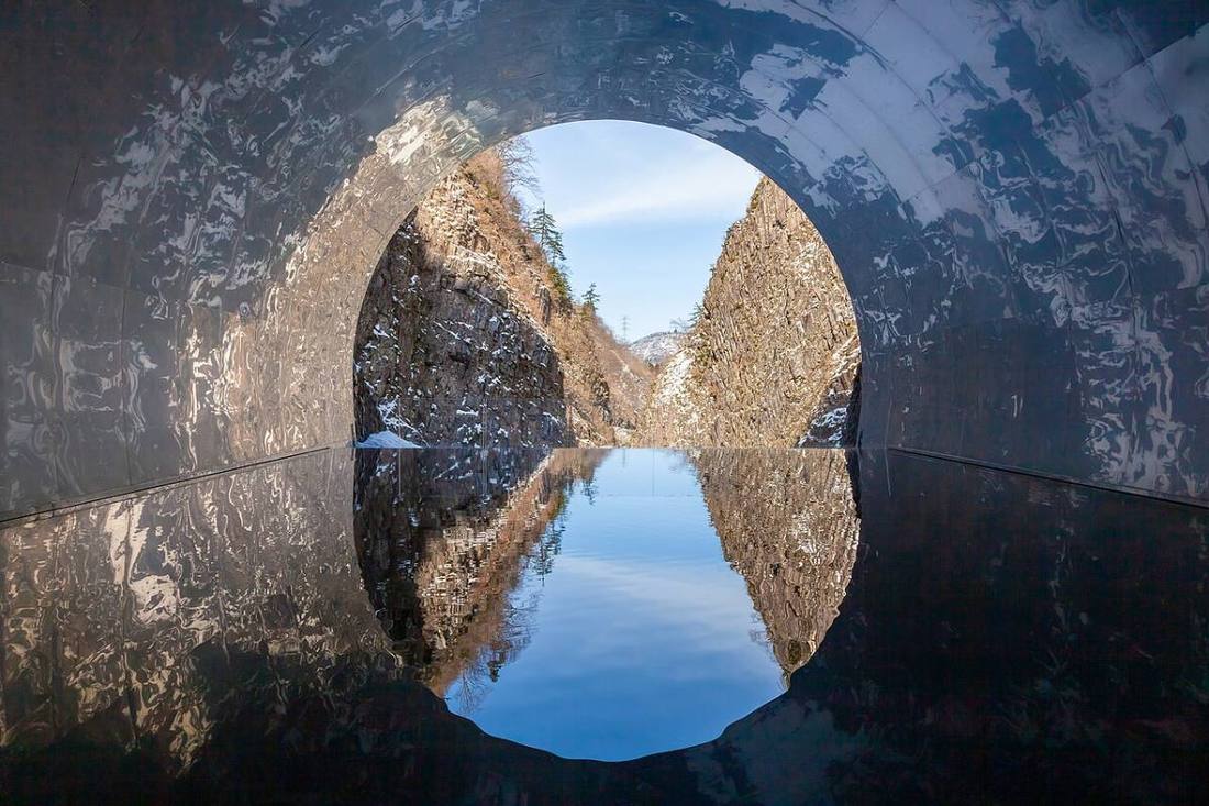
Photo: Yasuyuki_Kawano / CC BY 4.0 · Wikimedia Commons
Niigata Prefecture
Chubu region · Prefecture
Official website
Niigata Prefecture ranks 1st in Japan for rice harvest, and Uonuma Koshihikari is a byword for premium rice. It also has one of the largest numbers of sake breweries in Japan. With the metalworking of Tsubame-Sanjo and the gold mines of Sado Island, a persistent snow-country spirit of craftsmanship has taken root.
- Koshihikari rice
- Sake
- Tsubame-Sanjo metalworking
- Sado Island Gold Mines (World Cultural Heritage)
Key facts
- Municipalities
- 30 (20 cities, 6 towns, 4 villages)
Source: Statistics Bureau of Japan, 2025 Population Census (population, area and density); area from the Geospatial Information Authority of Japan (GSI), Area Statistics of Prefectures and Municipalities (2025). National ranks are among the 47 prefectures, ordered by this site from these values.
Places to know
- Niigata City The only designated city on the Sea of Japan side of Honshu. A port town at the mouth of the Shinano River.
- Minamiuonuma City Uonuma Koshihikari rice and ski areas.
- Sado City An island of the Japanese crested ibis (toki) and the Sado Gold Mine.
Current warnings, advisories and earthquakes
Places to visit in Niigata Prefecture
Browse by category
Shrines, temples, castles and historic sites
Chosen automatically, most popular first, from landmarks and cultural properties registered in Wikidata (we have not checked whether each is open). Names and descriptions: Wikidata (CC0); photos: Wikimedia Commons (photographer and license under each photo).
National parks in Niigata Prefecture
Chosen by overlaying the park boundaries (Ministry of the Environment, Biodiversity Center of Japan, "National Park Areas" GIS data, updated April 28, 2025, combined and simplified by NIPPON ATLAS) with municipal boundaries (National Land Numerical Information, January 2021), keeping overlaps of about 0.5 km² or more (approximate). Areas are the land areas from the Ministry of the Environment, "Overview of National Parks" (April 10, 2026). All national parks
Municipalities in Niigata Prefecture (30)
| Municipality | Population | 5-year change | Area | Temperature nownearest AMeDAS |
|---|
| Niigata City | 759,139 | −3.8% | 726 km² | |
| Nagaoka City | 251,069 | −5.9% | 891 km² | |
| Sanjo City | 88,396 | −6.6% | 432 km² | |
| Kashiwazaki City | 74,728 | −8.3% | 442 km² | |
| Shibata City | 89,570 | −5.6% | 533 km² | |
| Ojiya City | 31,408 | −7.9% | 155 km² | |
| Kamo City | 23,024 | −9.5% | 134 km² | |
| Tokamachi City | 44,509 | −10.7% | 590 km² | |
| Mitsuke City | 36,613 | −6.7% | 77.91 km² | |
| Murakami City | 51,422 | −10.4% | 1,174 km² | |
| Tsubame City | 73,706 | −4.5% | 111 km² | |
| Itoigawa City | 36,519 | −10.4% | 746 km² | |
| Myoko City | 27,860 | −8.3% | 446 km² | |
| Gosen City | 43,481 | −8.7% | 352 km² | |
| Joetsu City | 176,481 | −6.2% | 974 km² | |
| Agano City | 37,503 | −7.8% | 193 km² | |
| Sado City | 45,378 | −11.9% | 856 km² | |
| Uonuma City | 31,026 | −10.0% | 947 km² | |
| Minamiuonuma City | 51,184 | −6.7% | 585 km² | |
| Tainai City | 26,235 | −8.0% | 265 km² | |
| Seiro Town | 14,071 | −1.3% | 37.57 km² | |
| Yahiko Village | 7,114 | −7.7% | 25.17 km² | |
| Tagami Town | 10,287 | −8.4% | 31.71 km² | |
| Aga Town | 8,338 | −16.3% | 953 km² | |
| Izumozaki Town | 3,597 | −12.5% | 44.41 km² | |
| Yuzawa Town | 7,510 | −3.3% | 357 km² | |
| Tsunan Town | 7,959 | −11.5% | 170 km² | |
| Kariwa Village | 4,318 | −1.4% | 26.27 km² | |
| Sekikawa Village | 4,396 | −14.5% | 300 km² | |
| Awashimaura Village | 303 | −14.2% | 9.78 km² | |
Source: Statistics Bureau of Japan, 2025 Population Census (population in 2025; change compared with 2020). Area: GSI (2025). Designated cities are shown as one city (wards combined). "Temperature now" is the latest JMA AMeDAS observation (preliminary) at the nearest station in the same prefecture, loaded and shown unchanged when you open the page.