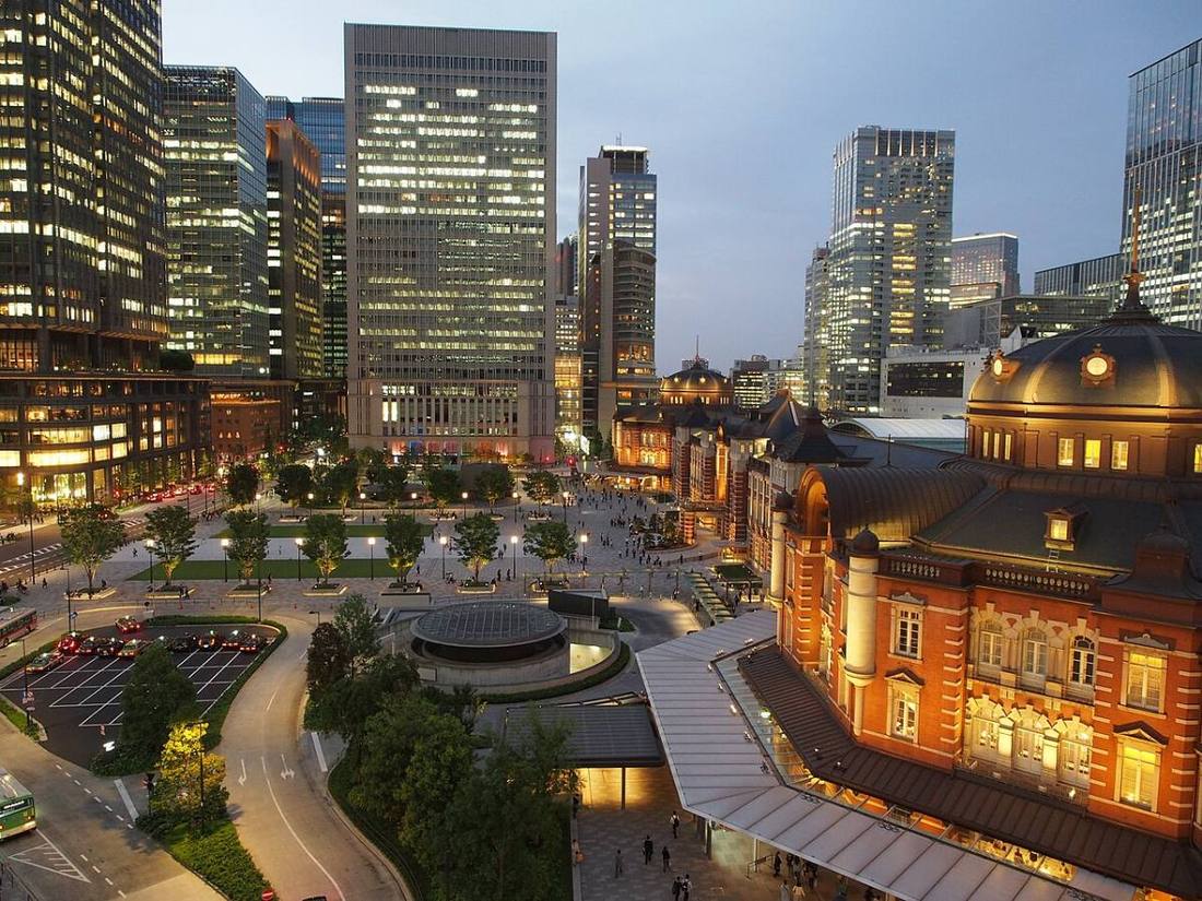
Photo: Kestrel / CC BY-SA 4.0 · Wikimedia Commons
Tokyo
Kanto region · Prefecture
Official website
Tokyo is the capital of Japan and has about 12% of the country's population. It is the center of politics, the economy and culture, yet it is also diverse, including the mountains of Okutama and the Ogasawara Islands, a World Natural Heritage Site far from the mainland.
- Capital of Japan
- 23 special wards
- Ogasawara (World Natural Heritage Site)
- Edo culture
Key facts
Source: Statistics Bureau of Japan, 2025 Population Census (population, area and density); area from the Geospatial Information Authority of Japan (GSI), Area Statistics of Prefectures and Municipalities (2025). National ranks are among the 47 prefectures, ordered by this site from these values.
Places to know
- Chiyoda City The heart of Japan, with the Imperial Palace, the National Diet Building and Marunouchi.
- Hachioji City The largest city in the Tama area, home to Mt. Takao.
- Ogasawara Village A paradise of endemic species with no airport, reached only by ship.
Current warnings, advisories and earthquakes
Places to visit in Tokyo
 Viewpoint · Sumida CityTokyo Skytreetower in Tokyo, Japan
 Viewpoint · Minato CityTokyo Towertower in Tokyo, Japan
 Island · Ogasawara VillageIwo Jimaisland of the Japanese Volcano Islands chain south of the Ogasawara Islands, site of the 1945 Battle of Iwo Jima
 Shinto shrine · Chiyoda City, TokyoYasukuni ShrineShinto shrine in Tokyo, Japan
 Castle · Chiyoda City, TokyoEdo Castlecastle in Tokyo, Japan
 Shopping street · Chiyoda City, TokyoAkihabaraNeighborhood/district of Chiyoda ward, Tokyo
 Museum · Taito CityTokyo National Museumart museum in Tokyo, Japan
 Island · Ogasawara VillageChichijimamain island of the Bonin/Ogasawara archipelago, administered as the seat of a subdistrict of Tokyo, Japan
 Important Cultural Property · Chiyoda City, TokyoTokyo Stationrailway and metro station in Chiyoda, Tokyo, Japan. Central station of Tokyo
 Museum · Taito CityNational Museum of Western Artart museum in Tokyo, Japan
Browse by category
Shrines, temples, castles and historic sites
Chosen automatically, most popular first, from landmarks and cultural properties registered in Wikidata (we have not checked whether each is open). Names and descriptions: Wikidata (CC0); photos: Wikimedia Commons (photographer and license under each photo).
National parks in Tokyo
Chosen by overlaying the park boundaries (Ministry of the Environment, Biodiversity Center of Japan, "National Park Areas" GIS data, updated April 28, 2025, combined and simplified by NIPPON ATLAS) with municipal boundaries (National Land Numerical Information, January 2021), keeping overlaps of about 0.5 km² or more (approximate). Areas are the land areas from the Ministry of the Environment, "Overview of National Parks" (April 10, 2026). All national parks
Municipalities in Tokyo (62)
| Municipality | Population | 5-year change | Area | Temperature nownearest AMeDAS |
|---|
| Chiyoda City | 66,270 | −0.6% | 11.66 km² | |
| Chuo City | 181,841 | +7.5% | 10.21 km² | |
| Minato City | 272,478 | +4.6% | 20.36 km² | |
| Shinjuku City | 361,357 | +3.4% | 18.22 km² | |
| Bunkyo City | 249,800 | +4.1% | 11.29 km² | |
| Taito City | 228,046 | +7.9% | 10.11 km² | |
| Sumida City | 285,038 | +4.8% | 13.77 km² | |
| Koto City | 553,502 | +5.6% | 42.99 km² | |
| Shinagawa City | 426,005 | +0.8% | 22.85 km² | |
| Meguro City | 286,082 | −0.7% | 14.67 km² | |
| Ota City | 758,181 | +1.4% | 61.86 km² | |
| Setagaya City | 954,737 | +1.2% | 58.05 km² | |
| Shibuya City | 238,826 | −2.1% | 15.11 km² | |
| Nakano City | 354,853 | +2.9% | 15.59 km² | |
| Suginami City | 597,038 | +1.0% | 34.06 km² | |
| Toshima City | 305,516 | +1.3% | 13.01 km² | |
| Kita City | 367,827 | +3.6% | 20.61 km² | |
| Arakawa City | 226,291 | +4.1% | 10.16 km² | |
| Itabashi City | 595,972 | +2.0% | 32.22 km² | |
| Nerima City | 760,819 | +1.1% | 48.08 km² | |
| Adachi City | 701,667 | +1.0% | 53.25 km² | |
| Katsushika City | 467,267 | +3.1% | 34.80 km² | |
| Edogawa City | 704,696 | +1.0% | 49.90 km² | |
| Hachioji City | 574,428 | −0.9% | 186 km² | |
| Tachikawa City | 189,304 | +3.1% | 24.36 km² | |
| Musashino City | 150,528 | +0.3% | 10.98 km² | |
| Mitaka City | 194,892 | −0.3% | 16.42 km² | |
| Ome City | 129,778 | −2.8% | 103 km² | |
| Fuchu City | 263,084 | +0.1% | 29.43 km² | |
| Akishima City | 116,590 | +2.3% | 17.34 km² | |
| Chofu City | 245,306 | +1.1% | 21.58 km² | |
| Machida City | 420,385 | −2.5% | 71.55 km² | |
| Koganei City | 128,953 | +2.3% | 11.30 km² | |
| Kodaira City | 198,691 | −0.0% | 20.51 km² | |
| Hino City | 190,616 | +0.1% | 27.55 km² | |
| Higashimurayama City | 152,134 | +0.2% | 17.14 km² | |
| Kokubunji City | 128,033 | −0.9% | 11.46 km² | |
| Kunitachi City | 76,546 | −0.8% | 8.15 km² | |
| Fussa City | 57,117 | +1.2% | 10.16 km² | |
| Komae City | 84,031 | −0.9% | 6.39 km² | |
| Higashiyamato City | 83,163 | −0.9% | 13.42 km² | |
| Kiyose City | 74,768 | −1.9% | 10.23 km² | |
| Higashikurume City | 115,239 | −0.0% | 12.88 km² | |
| Musashimurayama City | 69,057 | −2.5% | 15.32 km² | |
| Tama City | 141,575 | −3.7% | 21.01 km² | |
| Inagi City | 95,120 | +2.1% | 17.97 km² | |
| Hamura City | 53,438 | −1.6% | 9.90 km² | |
| Akiruno City | 77,141 | −2.7% | 73.47 km² | |
| Nishitokyo City | 207,409 | +0.0% | 15.75 km² | |
| Mizuho Town | 31,097 | −2.1% | 16.85 km² | |
| Hinode Town | 16,078 | −5.2% | 28.07 km² | |
| Hinohara Village | 1,764 | −11.9% | 105 km² | |
| Okutama Town | 4,206 | −11.5% | 226 km² | |
| Oshima Town | 6,297 | −11.3% | 90.76 km² | |
| Toshima Village | 304 | −7.0% | 4.04 km² | |
| Niijima Village | 2,167 | −11.2% | 27.54 km² | |
| Kozushima Village | 1,654 | −10.8% | 18.58 km² | |
| Miyake Village | 1,986 | −12.6% | 55.26 km² | |
| Mikurajima Village | 294 | −9.0% | 20.39 km² | |
| Hachijo Town | 6,466 | −8.2% | 72.24 km² | |
| Aogashima Village | 168 | −0.6% | 5.95 km² | |
| Ogasawara Village | 2,711 | −7.4% | 113 km² | |
Source: Statistics Bureau of Japan, 2025 Population Census (population in 2025; change compared with 2020). Area: GSI (2025). Designated cities are shown as one city (wards combined). "Temperature now" is the latest JMA AMeDAS observation (preliminary) at the nearest station in the same prefecture, loaded and shown unchanged when you open the page.