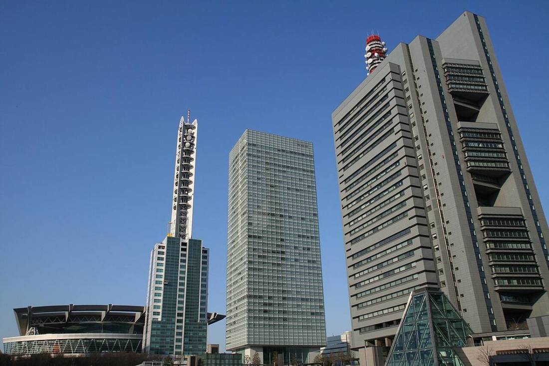
Photo: User:PRiMENON / CC BY-SA 3.0 · Wikimedia Commons
Saitama Prefecture
Kanto region · Prefecture
Official website
Saitama ranks 5th in Japan in population, and with 40 cities it has the most cities of any prefecture. Many residents commute to central Tokyo, yet history and nature are also close at hand, such as the storehouse-style streets of Kawagoe and the mountains of Chichibu.
- Kawagoe, "Little Edo"
- Chichibu Night Festival
- The Railway Museum
- Soka senbei (rice crackers)
Key facts
- Municipalities
- 63 (40 cities, 22 towns, 1 village)
Source: Statistics Bureau of Japan, 2025 Population Census (population, area and density); area from the Geospatial Information Authority of Japan (GSI), Area Statistics of Prefectures and Municipalities (2025). National ranks are among the 47 prefectures, ordered by this site from these values.
Places to know
- Saitama City A designated city that includes Omiya and Urawa. Home to the Railway Museum and the Bonsai Village.
- Kawagoe City Streets of storehouse-style buildings and the Toki no Kane bell tower.
- Chichibu City The Chichibu Night Festival and sightseeing among the mountains.
Current warnings, advisories and earthquakes
Places to visit in Saitama Prefecture
 Shinto shrine · Saitama CityHikawa ShrineShinto shrine in Saitama, Japan
 Burial mound (kofun) · Gyoda CityInariyama Kofunburial mound in Gyōda, Saitama, Japan
 Castle · Kawagoe City, SaitamaKawagoe Castlefortification
 Shinto shrine · Chichibu CityMitsumine ShrineShinto shrine in Saitama Prefecture, Japan
 Castle · Yorii TownHachigata Castlebuilding in Yorii, Saitama Prefecture, Japan
 Special historic site · Gyoda CitySakitama Kofun Clusterkofun in Saitama, Japan
 Museum · Saitama CityRailway Museumrailway museum in Saitama, Saitama, Japan
 Zoo · Miyashiro TownTobu Zoozoo and amusement park in Japan
 Buddhist temple · Kumagaya CityKangi-in TempleBuddhist temple
 Amusement park · Tokorozawa CitySeibu-enamusement park in Tokorozawa, Japan
Browse by category
Shrines, temples, castles and historic sites
Chosen automatically, most popular first, from landmarks and cultural properties registered in Wikidata (we have not checked whether each is open). Names and descriptions: Wikidata (CC0); photos: Wikimedia Commons (photographer and license under each photo).
National parks in Saitama Prefecture
Chosen by overlaying the park boundaries (Ministry of the Environment, Biodiversity Center of Japan, "National Park Areas" GIS data, updated April 28, 2025, combined and simplified by NIPPON ATLAS) with municipal boundaries (National Land Numerical Information, January 2021), keeping overlaps of about 0.5 km² or more (approximate). Areas are the land areas from the Ministry of the Environment, "Overview of National Parks" (April 10, 2026). All national parks
Municipalities in Saitama Prefecture (63)
| Municipality | Population | 5-year change | Area | Temperature nownearest AMeDAS |
|---|
| Saitama City | 1,344,865 | +1.6% | 217 km² | |
| Kawagoe City | 354,567 | −0.0% | 109 km² | |
| Kumagaya City | 188,037 | −3.3% | 160 km² | |
| Kawaguchi City | 591,712 | −0.4% | 61.95 km² | |
| Gyoda City | 76,111 | −3.2% | 67.49 km² | |
| Chichibu City | 54,609 | −8.5% | 578 km² | |
| Tokorozawa City | 342,537 | +0.0% | 72.11 km² | |
| Hanno City | 77,707 | −3.3% | 193 km² | |
| Kazo City | 109,480 | −1.9% | 133 km² | |
| Honjo City | 76,337 | −2.8% | 89.69 km² | |
| Higashimatsuyama City | 91,816 | +0.0% | 65.35 km² | |
| Kasukabe City | 223,939 | −2.5% | 66.00 km² | |
| Sayama City | 142,970 | −3.9% | 48.99 km² | |
| Hanyu City | 52,198 | −1.3% | 58.64 km² | |
| Konosu City | 115,494 | −1.1% | 67.44 km² | |
| Fukaya City | 138,393 | −2.0% | 138 km² | |
| Ageo City | 224,634 | −1.0% | 45.51 km² | |
| Soka City | 251,360 | +1.2% | 27.46 km² | |
| Koshigaya City | 341,497 | −0.0% | 60.24 km² | |
| Warabi City | 75,454 | +1.6% | 5.11 km² | |
| Toda City | 139,232 | −1.2% | 18.19 km² | |
| Iruma City | 140,150 | −3.8% | 44.69 km² | |
| Asaka City | 147,233 | +4.4% | 18.34 km² | |
| Shiki City | 75,036 | −0.4% | 9.05 km² | |
| Wako City | 83,591 | −0.5% | 11.04 km² | |
| Niiza City | 164,882 | −0.7% | 22.78 km² | |
| Okegawa City | 72,962 | −2.4% | 25.35 km² | |
| Kuki City | 147,464 | −2.1% | 82.41 km² | |
| Kitamoto City | 64,319 | −1.4% | 19.82 km² | |
| Yashio City | 93,410 | +0.1% | 18.02 km² | |
| Fujimi City | 112,751 | +0.8% | 19.77 km² | |
| Misato City | 140,568 | −1.1% | 30.13 km² | |
| Hasuda City | 60,368 | −1.8% | 27.28 km² | |
| Sakado City | 99,273 | −1.0% | 41.02 km² | |
| Satte City | 47,754 | −4.6% | 33.93 km² | |
| Tsurugashima City | 70,627 | +0.7% | 17.65 km² | |
| Hidaka City | 53,231 | −2.5% | 47.48 km² | |
| Yoshikawa City | 71,291 | −1.0% | 31.66 km² | |
| Fujimino City | 112,322 | −1.1% | 14.64 km² | |
| Shiraoka City | 51,461 | −1.4% | 24.92 km² | |
| Ina Town | 44,498 | −0.8% | 14.79 km² | |
| Miyoshi Town | 37,440 | −2.6% | 15.33 km² | |
| Moroyama Town | 33,251 | −6.0% | 34.07 km² | |
| Ogose Town | 10,254 | −7.0% | 40.39 km² | |
| Namegawa Town | 19,911 | +0.9% | 29.68 km² | |
| Ranzan Town | 17,332 | −3.1% | 29.92 km² | |
| Ogawa Town | 26,272 | −7.9% | 60.36 km² | |
| Kawajima Town | 17,873 | −7.8% | 41.63 km² | |
| Yoshimi Town | 16,823 | −7.5% | 38.64 km² | |
| Hatoyama Town | 12,639 | −6.8% | 25.73 km² | |
| Tokigawa Town | 9,767 | −7.3% | 55.90 km² | |
| Yokoze Town | 7,230 | −9.4% | 49.36 km² | |
| Minano Town | 8,430 | −9.4% | 63.74 km² | |
| Nagatoro Town | 6,112 | −10.2% | 30.43 km² | |
| Ogano Town | 9,465 | −13.4% | 171 km² | |
| Higashichichibu Village | 2,289 | −15.5% | 37.06 km² | |
| Misato Town | 10,318 | −6.5% | 33.41 km² | |
| Kamikawa Town | 12,480 | −6.6% | 47.40 km² | |
| Kamisato Town | 29,611 | −2.4% | 29.18 km² | |
| Yorii Town | 30,683 | −5.2% | 64.25 km² | |
| Miyashiro Town | 33,542 | −1.8% | 15.95 km² | |
| Sugito Town | 42,574 | −2.9% | 30.03 km² | |
| Matsubushi Town | 26,889 | −4.9% | 16.20 km² | |
Source: Statistics Bureau of Japan, 2025 Population Census (population in 2025; change compared with 2020). Area: GSI (2025). Designated cities are shown as one city (wards combined). "Temperature now" is the latest JMA AMeDAS observation (preliminary) at the nearest station in the same prefecture, loaded and shown unchanged when you open the page.