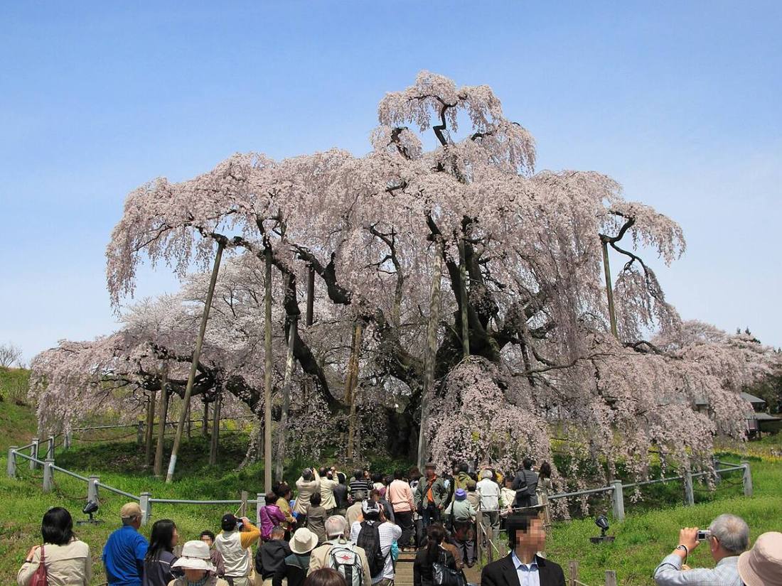
Photo: 日本語版ウィキペディアの京浜にけさん / CC BY-SA 3.0 · Wikimedia Commons
Fukushima Prefecture
Hokkaido & Tohoku region · Prefecture
Official website
Fukushima is the 3rd largest prefecture in Japan. Its three regions, Hamadori, Nakadori and Aizu, differ greatly in climate and culture. Its attractions include peaches and other fruit, the sake breweries of Aizu, and the scenery of Mt. Bandai and Lake Inawashiro.
- Peaches
- Aizu sake
- Mt. Bandai
- Oze
Key facts
- Municipalities
- 59 (13 cities, 31 towns, 15 villages)
Source: Statistics Bureau of Japan, 2025 Population Census (population, area and density); area from the Geospatial Information Authority of Japan (GSI), Area Statistics of Prefectures and Municipalities (2025). National ranks are among the 47 prefectures, ordered by this site from these values.
Places to know
- Aizuwakamatsu City Tsuruga Castle, the Byakkotai (White Tiger Force) and the history of a castle town.
- Koriyama City The economic and transport center of the prefecture.
- Shimogo Town Ouchi-juku, a former post town lined with thatched-roof houses.
Current warnings, advisories and earthquakes
Places to visit in Fukushima Prefecture
Browse by category
Shrines, temples, castles and historic sites
Chosen automatically, most popular first, from landmarks and cultural properties registered in Wikidata (we have not checked whether each is open). Names and descriptions: Wikidata (CC0); photos: Wikimedia Commons (photographer and license under each photo).
National parks in Fukushima Prefecture
Chosen by overlaying the park boundaries (Ministry of the Environment, Biodiversity Center of Japan, "National Park Areas" GIS data, updated April 28, 2025, combined and simplified by NIPPON ATLAS) with municipal boundaries (National Land Numerical Information, January 2021), keeping overlaps of about 0.5 km² or more (approximate). Areas are the land areas from the Ministry of the Environment, "Overview of National Parks" (April 10, 2026). All national parks
Municipalities in Fukushima Prefecture (59)
| Municipality | Population | 5-year change | Area | Temperature nownearest AMeDAS |
|---|
| Fukushima City | 265,537 | −6.1% | 768 km² | |
| Aizuwakamatsu City | 108,941 | −7.2% | 383 km² | |
| Koriyama City | 312,873 | −4.5% | 757 km² | |
| Iwaki City | 306,165 | −8.0% | 1,233 km² | |
| Shirakawa City | 55,322 | −7.0% | 305 km² | |
| Sukagawa City | 71,073 | −5.2% | 279 km² | |
| Kitakata City | 41,660 | −6.9% | 555 km² | |
| Soma City | 31,841 | −8.7% | 198 km² | |
| Nihonmatsu City | 49,234 | −8.1% | 344 km² | |
| Tamura City | 31,812 | −9.5% | 458 km² | |
| Minamisoma City | 54,066 | −8.4% | 399 km² | |
| Date City | 54,107 | −7.1% | 265 km² | |
| Motomiya City | 29,610 | −2.1% | 88.02 km² | |
| Koori Town | 10,706 | −6.6% | 42.97 km² | |
| Kunimi Town | 7,696 | −10.9% | 37.95 km² | |
| Kawamata Town | 10,841 | −10.9% | 128 km² | |
| Otama Village | 8,931 | +0.3% | 79.44 km² | |
| Kagamiishi Town | 12,009 | −2.5% | 31.30 km² | |
| Ten-ei Village | 4,823 | −7.1% | 226 km² | |
| Shimogo Town | 4,464 | −15.2% | 317 km² | |
| Hinoemata Village | 475 | −5.8% | 390 km² | |
| Tadami Town | 3,463 | −14.4% | 748 km² | |
| Minamiaizu Town | 12,599 | −12.8% | 886 km² | |
| Kitashiobara Village | 2,183 | −14.6% | 234 km² | |
| Nishiaizu Town | 5,058 | −12.3% | 298 km² | |
| Bandai Town | 3,028 | −8.9% | 59.77 km² | |
| Inawashiro Town | 11,951 | −11.8% | 395 km² | |
| Aizubange Town | 13,552 | −10.1% | 91.59 km² | |
| Yugawa Village | 2,831 | −8.1% | 16.37 km² | |
| Yanaizu Town | 2,610 | −15.3% | 176 km² | |
| Mishima Town | 1,215 | −16.3% | 90.81 km² | |
| Kaneyama Town | 1,634 | −12.2% | 294 km² | |
| Showa Village | 1,063 | −14.7% | 209 km² | |
| Aizumisato Town | 17,278 | −9.1% | 276 km² | |
| Nishigo Village | 20,740 | −0.3% | 192 km² | |
| Izumizaki Village | 5,825 | −6.2% | 35.43 km² | |
| Nakajima Village | 4,500 | −7.9% | 18.92 km² | |
| Yabuki Town | 16,463 | −4.8% | 60.40 km² | |
| Tanagura Town | 11,976 | −10.2% | 160 km² | |
| Yamatsuri Town | 4,741 | −12.1% | 118 km² | |
| Hanawa Town | 7,405 | −10.8% | 211 km² | |
| Samegawa Village | 2,626 | −13.9% | 131 km² | |
| Ishikawa Town | 13,244 | −9.6% | 116 km² | |
| Tamakawa Village | 5,698 | −10.9% | 46.67 km² | |
| Hirata Village | 5,198 | −10.8% | 93.42 km² | |
| Asakawa Town | 5,423 | −10.2% | 37.45 km² | |
| Furudono Town | 4,137 | −14.3% | 163 km² | |
| Miharu Town | 15,808 | −7.1% | 72.76 km² | |
| Ono Town | 8,329 | −12.1% | 125 km² | |
| Hirono Town | 4,777 | −11.7% | 58.69 km² | |
| Naraha Town | 4,536 | +22.3% | 104 km² | |
| Tomioka Town | 2,894 | +36.0% | 68.39 km² | |
| Kawauchi Village | 1,702 | −16.7% | 197 km² | |
| Okuma Town | 1,533 | +81.0% | 78.73 km² | |
| Futaba Town | 211 | — | 51.42 km² | |
| Namie Town | 2,574 | +33.9% | 223 km² | |
| Katsurao Village | 418 | −0.5% | 84.37 km² | |
| Shinchi Town | 7,480 | −5.4% | 46.70 km² | |
| Iitate Village | 1,353 | +2.7% | 230 km² | |
Source: Statistics Bureau of Japan, 2025 Population Census (population in 2025; change compared with 2020). Area: GSI (2025). Designated cities are shown as one city (wards combined). "Temperature now" is the latest JMA AMeDAS observation (preliminary) at the nearest station in the same prefecture, loaded and shown unchanged when you open the page.