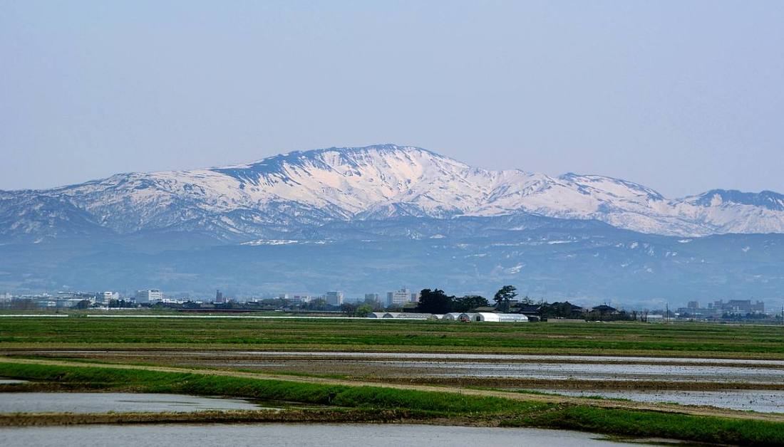
Photo: Jun K / CC BY-SA 2.0 · Wikimedia Commons
Yamagata Prefecture
Hokkaido & Tohoku region · Prefecture
Official website
Yamagata produces the most cherries in Japan. It is a prefecture of mountains, faith and hot springs, with the mountain worship of the Three Mountains of Dewa, the frost-covered trees of Zao and the streets of Ginzan Onsen. It is also known for having hot springs in every municipality in the prefecture.
- Cherries
- Three Mountains of Dewa (Dewa Sanzan)
- Frost-covered trees of Zao
- Imoni (taro stew)
Key facts
- Municipalities
- 35 (13 cities, 19 towns, 3 villages)
Source: Statistics Bureau of Japan, 2025 Population Census (population, area and density); area from the Geospatial Information Authority of Japan (GSI), Area Statistics of Prefectures and Municipalities (2025). National ranks are among the 47 prefectures, ordered by this site from these values.
Places to know
- Yamagata City Yamadera (Risshaku-ji Temple) and Zao Onsen.
- Tsuruoka City A temple town at the foot of the Three Mountains of Dewa, and a UNESCO Creative City of Gastronomy.
- Obanazawa City Ginzan Onsen, with its romantic Taisho-era atmosphere, and watermelons.
Current warnings, advisories and earthquakes
Places to visit in Yamagata Prefecture
 Landmark · Tsuruoka CityThree Mountains of Dewamountains in Yamagata Prefecture, Japan
 Island · Sakata CityTobishimaJapanese island in the Yamagata prefecture
 Buddhist temple · Yamagata City, YamagataYama-dera TempleBuddhist temple in Yamagata Prefecture, Japan
 Hot spring (onsen) · Obanazawa CityGinzan Onsenbuilding in Yamagata Prefecture, Japan
 Castle · Yamagata City, YamagataYamagata Castlecastle in Yamagata city, Japan
 Castle · Yonezawa CityYonezawa Castlebuilding in Yonezawa, Yamagata Prefecture, Japan
 Shinto shrine · Tsuruoka CityFive-storied Pagoda, Haguro-sanShinto shrine in Yamagata Prefecture, Japan
 Hot spring (onsen) · Yamagata City, YamagataZao Onsenhot spring and ski resort in Yamagata Prefecture, Japan
 Castle · Kaminoyama CityKaminoyama Castlebuilding in Kaminoyama, Yamagata Prefecture, Japan
 Aquarium · Tsuruoka CityKamo Aquariumzoo in Yamagata, Japan
Browse by category
Shrines, temples, castles and historic sites
Chosen automatically, most popular first, from landmarks and cultural properties registered in Wikidata (we have not checked whether each is open). Names and descriptions: Wikidata (CC0); photos: Wikimedia Commons (photographer and license under each photo).
National parks in Yamagata Prefecture
Chosen by overlaying the park boundaries (Ministry of the Environment, Biodiversity Center of Japan, "National Park Areas" GIS data, updated April 28, 2025, combined and simplified by NIPPON ATLAS) with municipal boundaries (National Land Numerical Information, January 2021), keeping overlaps of about 0.5 km² or more (approximate). Areas are the land areas from the Ministry of the Environment, "Overview of National Parks" (April 10, 2026). All national parks
Municipalities in Yamagata Prefecture (35)
| Municipality | Population | 5-year change | Area | Temperature nownearest AMeDAS |
|---|
| Yamagata City | 235,431 | −4.9% | 381 km² | |
| Yonezawa City | 76,033 | −6.4% | 549 km² | |
| Tsuruoka City | 113,051 | −7.6% | 1,312 km² | |
| Sakata City | 92,053 | −8.2% | 603 km² | |
| Shinjo City | 31,661 | −8.0% | 223 km² | |
| Sagae City | 38,133 | −5.1% | 139 km² | |
| Kaminoyama City | 26,724 | −8.2% | 241 km² | |
| Murayama City | 20,200 | −10.3% | 197 km² | |
| Nagai City | 24,561 | −7.5% | 215 km² | |
| Tendo City | 59,721 | −3.9% | 113 km² | |
| Higashine City | 47,386 | −0.6% | 207 km² | |
| Obanazawa City | 12,783 | −14.6% | 373 km² | |
| Nanyo City | 28,049 | −7.8% | 161 km² | |
| Yamanobe Town | 12,883 | −6.1% | 61.45 km² | |
| Nakayama Town | 10,009 | −6.9% | 31.15 km² | |
| Kahoku Town | 16,183 | −8.3% | 52.45 km² | |
| Nishikawa Town | 4,251 | −14.2% | 393 km² | |
| Asahi Town | 5,447 | −14.4% | 197 km² | |
| Oe Town | 6,692 | −12.5% | 154 km² | |
| Oishida Town | 5,558 | −15.5% | 79.54 km² | |
| Kaneyama Town | 4,408 | −13.1% | 162 km² | |
| Mogami Town | 6,978 | −13.6% | 330 km² | |
| Funagata Town | 4,474 | −10.6% | 119 km² | |
| Mamurogawa Town | 6,130 | −14.9% | 374 km² | |
| Okura Village | 2,572 | −15.1% | 212 km² | |
| Sakegawa Village | 3,411 | −12.6% | 122 km² | |
| Tozawa Village | 3,552 | −15.4% | 261 km² | |
| Takahata Town | 20,401 | −9.2% | 180 km² | |
| Kawanishi Town | 12,942 | −11.1% | 167 km² | |
| Oguni Town | 6,136 | −13.7% | 738 km² | |
| Shirataka Town | 11,623 | −9.8% | 158 km² | |
| Iide Town | 5,868 | −11.3% | 329 km² | |
| Mikawa Town | 7,145 | −6.0% | 33.22 km² | |
| Shonai Town | 18,337 | −9.0% | 249 km² | |
| Yuza Town | 11,511 | −11.7% | 208 km² | |
Source: Statistics Bureau of Japan, 2025 Population Census (population in 2025; change compared with 2020). Area: GSI (2025). Designated cities are shown as one city (wards combined). "Temperature now" is the latest JMA AMeDAS observation (preliminary) at the nearest station in the same prefecture, loaded and shown unchanged when you open the page.