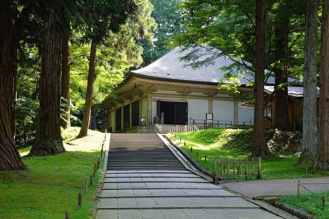
Photo: 663highland / CC BY-SA 4.0 · Wikimedia Commons
Iwate Prefecture
Hokkaido & Tohoku region · Prefecture
Official website
Iwate is the largest prefecture after Hokkaido. It is known for the ria coastline of the Sanriku coast, the culture of Hiraizumi built by the Oshu Fujiwara clan, and as the home of Miyazawa Kenji. Wanko soba (buckwheat noodles served in small bowls, one after another) and Nanbu ironware are also local specialties.
- Hiraizumi (World Cultural Heritage Site)
- Sanriku Coast
- Nanbu ironware
- Wanko soba
Key facts
- Municipalities
- 33 (14 cities, 15 towns, 4 villages)
Source: Statistics Bureau of Japan, 2025 Population Census (population, area and density); area from the Geospatial Information Authority of Japan (GSI), Area Statistics of Prefectures and Municipalities (2025). National ranks are among the 47 prefectures, ordered by this site from these values.
Places to know
- Morioka City A city of three great noodle dishes: reimen (cold noodles), jajamen and wanko soba.
- Hiraizumi Town The Konjikido (Golden Hall) of Chuson-ji Temple, and Motsu-ji Temple.
- Hanamaki City The birthplace of Miyazawa Kenji, with many hot spring resorts.
Current warnings, advisories and earthquakes
Places to visit in Iwate Prefecture
 Buddhist temple · Hiraizumi TownChuson-ji TempleBuddhist temple in Iwate Prefecture, Japan
 Buddhist temple · Hiraizumi TownMotsu-ji TempleBuddhist temple in Iwate Prefecture, Japan
- Buddhist temple · Hiraizumi TownChuson-ji Konjikidobuilding in Hiraizumi, Iwate Prefecture, Japan
 Natural monument · Miyako City, IwateMt. Hayachinemountain in Iwate Prefecture, Japan
 Castle · Morioka CityMorioka Castlefortification
 World Heritage Site · Hiraizumi TownKinkeizanmountain in Hiraizumi, Japan
 Coast · Miyako City, IwateJodogahamaPart of the Rikuchū Kaigan National Park, in Miyako, Iwate Prefecture, Japan.
 Gorge · Ichinoseki CityGeibikei
 World Heritage Site · Kamaishi CityHashino iron mining and smelting siteUNESCO World Heritage Site in Honshu, Japan
 Valley · Ichinoseki CityGenbikeiravine on the Iwai River in Japan
Browse by category
Shrines, temples, castles and historic sites
Chosen automatically, most popular first, from landmarks and cultural properties registered in Wikidata (we have not checked whether each is open). Names and descriptions: Wikidata (CC0); photos: Wikimedia Commons (photographer and license under each photo).
National parks in Iwate Prefecture
Chosen by overlaying the park boundaries (Ministry of the Environment, Biodiversity Center of Japan, "National Park Areas" GIS data, updated April 28, 2025, combined and simplified by NIPPON ATLAS) with municipal boundaries (National Land Numerical Information, January 2021), keeping overlaps of about 0.5 km² or more (approximate). Areas are the land areas from the Ministry of the Environment, "Overview of National Parks" (April 10, 2026). All national parks
Municipalities in Iwate Prefecture (33)
| Municipality | Population | 5-year change | Area | Temperature nownearest AMeDAS |
|---|
| Morioka City | 278,444 | −3.9% | 886 km² | |
| Miyako City | 44,247 | −12.2% | 1,259 km² | |
| Ofunato City | 30,565 | −12.0% | 323 km² | |
| Hanamaki City | 87,233 | −6.4% | 908 km² | |
| Kitakami City | 90,811 | −2.4% | 438 km² | |
| Kuji City | 29,622 | −10.4% | 624 km² | |
| Tono City | 22,625 | −10.8% | 826 km² | |
| Ichinoseki City | 101,810 | −9.0% | 1,256 km² | |
| Rikuzentakata City | 16,395 | −10.2% | 232 km² | |
| Kamaishi City | 27,992 | −12.7% | 440 km² | |
| Ninohe City | 22,975 | −9.9% | 420 km² | |
| Hachimantai City | 22,060 | −8.2% | 862 km² | |
| Oshu City | 103,802 | −8.1% | 993 km² | |
| Takizawa City | 53,711 | −3.4% | 182 km² | |
| Shizukuishi Town | 14,286 | −9.2% | 609 km² | |
| Kuzumaki Town | 4,874 | −13.5% | 435 km² | |
| Iwate Town | 10,652 | −13.3% | 360 km² | |
| Shiwa Town | 31,441 | −2.2% | 239 km² | |
| Yahaba Town | 26,981 | −3.8% | 67.32 km² | |
| Nishiwaga Town | 4,355 | −15.2% | 591 km² | |
| Kanegasaki Town | 15,110 | −2.7% | 180 km² | |
| Hiraizumi Town | 6,422 | −11.4% | 63.39 km² | |
| Sumita Town | 4,331 | −14.2% | 335 km² | |
| Otsuchi Town | 9,850 | −10.5% | 200 km² | |
| Yamada Town | 12,680 | −11.5% | 263 km² | |
| Iwaizumi Town | 7,421 | −15.0% | 992 km² | |
| Tanohata Village | 2,678 | −12.5% | 156 km² | |
| Fudai Village | 2,132 | −14.3% | 69.66 km² | |
| Karumai Town | 7,410 | −12.0% | 246 km² | |
| Noda Village | 3,609 | −8.3% | 80.80 km² | |
| Kunohe Village | 4,713 | −12.4% | 134 km² | |
| Hirono Town | 13,406 | −11.2% | 303 km² | |
| Ichinohe Town | 10,009 | −12.9% | 300 km² | |
Source: Statistics Bureau of Japan, 2025 Population Census (population in 2025; change compared with 2020). Area: GSI (2025). Designated cities are shown as one city (wards combined). "Temperature now" is the latest JMA AMeDAS observation (preliminary) at the nearest station in the same prefecture, loaded and shown unchanged when you open the page.